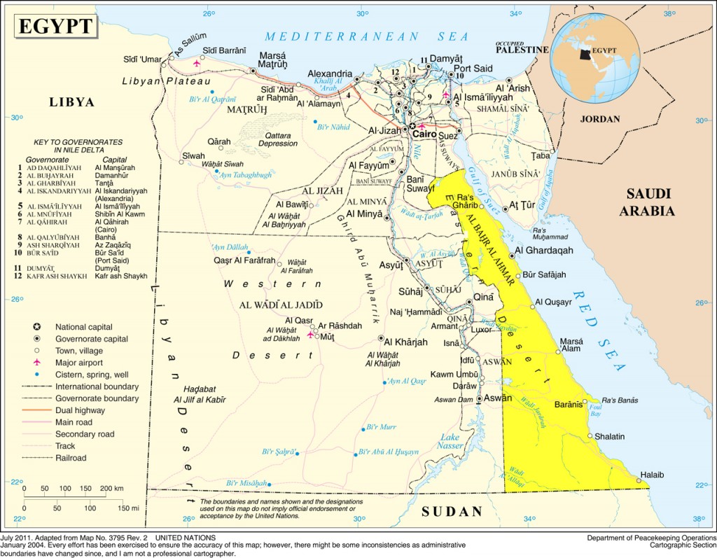
1250 km of turquoise waters, splendid corals, exotic fish, and windswept beaches. Monasteries, arid hills, mountains, and ancient ports long forgotten, welcome to the Red Sea and Eastern Desert.
Due to the size of the Red Sea governorate and the Eastern desert, this guide is going to be split into two parts: the Coast and the Eastern Desert.
The Red Sea: Coast can be found here.
The Eastern Desert and the Red Sea Mountains
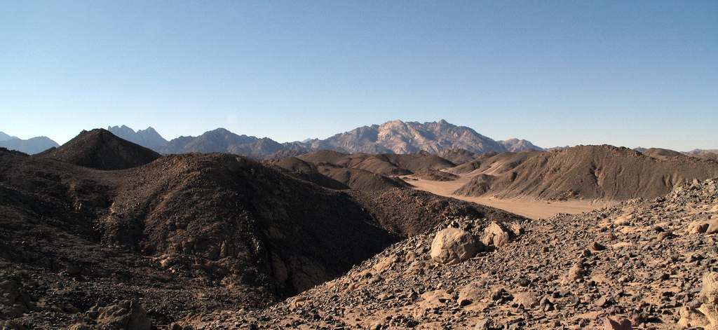
The topographic features of the region east of the Nile are very different from those of the Western Desert. The relatively mountainous Eastern Desert rises abruptly from the Nile and extends over an area of approximately 220,000 km2 (an area roughly equivalent to that covered by Utah). The upward-sloping plateau of sand gives way within 100 km to arid, defoliated, rocky hills running north and south between the Sudan border and the Delta. The hills reach elevations of more than 1,900 m. The region’s most prominent feature is the easterly chain of rugged mountains, the Red Sea Hills, which extend from the Nile Valley eastward to the Gulf of Suez and the Red Sea. This elevated region has a natural drainage pattern that rarely functions because of insufficient rainfall. It also has a complex of irregular, sharply cut wadis that extend westward toward the Nile.
The Eastern Desert is generally isolated from the rest of the country. There is no oasis cultivation in the region because of the difficulty in sustaining any form of agriculture. Except for a few villages on the Red Sea coast, there are no permanent settlements. Source.
The Eastern Desert
The Ancient Egyptians, the Greeks, and the Romans, have mined and quarried the Eastern desert and its mountains for its rich supply of stones and ores: granite, marble, gold, emeralds, breccia, porphyry, and serpentine have all been found here in abundance and some of them are still quarried to this day.
The Eastern Desert wasn’t always a desert, at some point as recently as 4,500 years ago; the desert was a damp place, full of animals that, now, exist only in sub Saharan Africa, animals that have been depicted in rock art in wadis (valleys) and caves dotted throughout the Eastern desert.
It’s rocky, full of ancient valleys, mountains, and hills. Welcome to the Egyptian highlands.
At the northernmost edge of the Eastern Desert is Jebel ‘Ataqa (Mount ‘Ataqa), the northern most mountain, this is where the hot sulphur springs (35°C) of Al-Ain Al-Sukhna.
The Monasteries
Over 16 centuries ago, monasticism was born in Egypt at the hands of St. Anthony, born in 251CE to a wealthy Egyptian landowner, he gave away his inheritance to the poor, studied under a local holy man, then eventually made his way to the Eastern Desert, retreating to a cave in Jebel Al-Jalalah Al-Quibliya to escape all worldly affairs. He was followed by several supplicants, who established themselves at the base of the mountain, that base eventually became the very first monastery in the world, the monastery of St. Anthony.
About 300m above the monastery and 45 minutes later you get to St. Anthony’s Cave, with stunning views of the wadis and massifs as they meet the azure waters of the Red Sea. The cave itself contains medieval graffiti, and an abundance of birdlife surrounds it; even some very shy gazelles make an appearance every now and then.
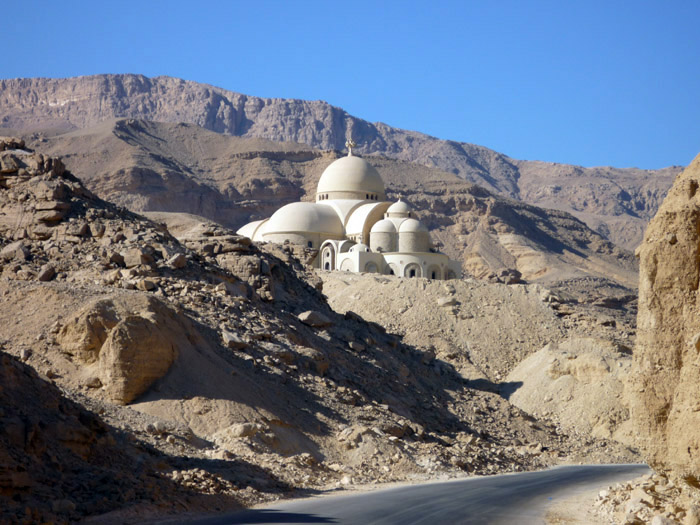
The St. Paul monastery, one of the oldest monasteries in the world, is just a bit newer than the neighbouring St. Anthony's. By Miami Love 1, Flickr.
A little to the south of St. Anthony’s monastery lays the monastery of St. Paul, a devotee of the St. Anthony, who died years before his teacher. Both monasteries are filled with icons, and beautifully coloured murals, and are open for visitors daily, except on Christian holidays.
The Red Sea Mountains
Inland from Ras Gharib, and south of the monasteries is Jebel Gharib (Mount Gharib) 1,757m, which makes for an interesting tackle by mountaineers
The Red Sea Mountains are a series of rugged mountains that formed and shaped by the same violent earth movements and volcanic activity that formed the Red Sea rift. They are formed from the most ancient rock in Egypt, with some dating back more than 550 million years.
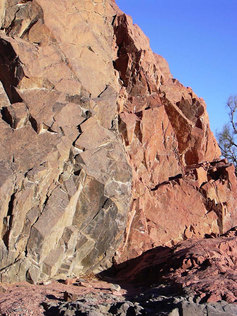
Stones of the red sea mountains in Egypt - about 50 km away from Hurghada at the Red Sea. By tanja555 (Tanja), Flickr.
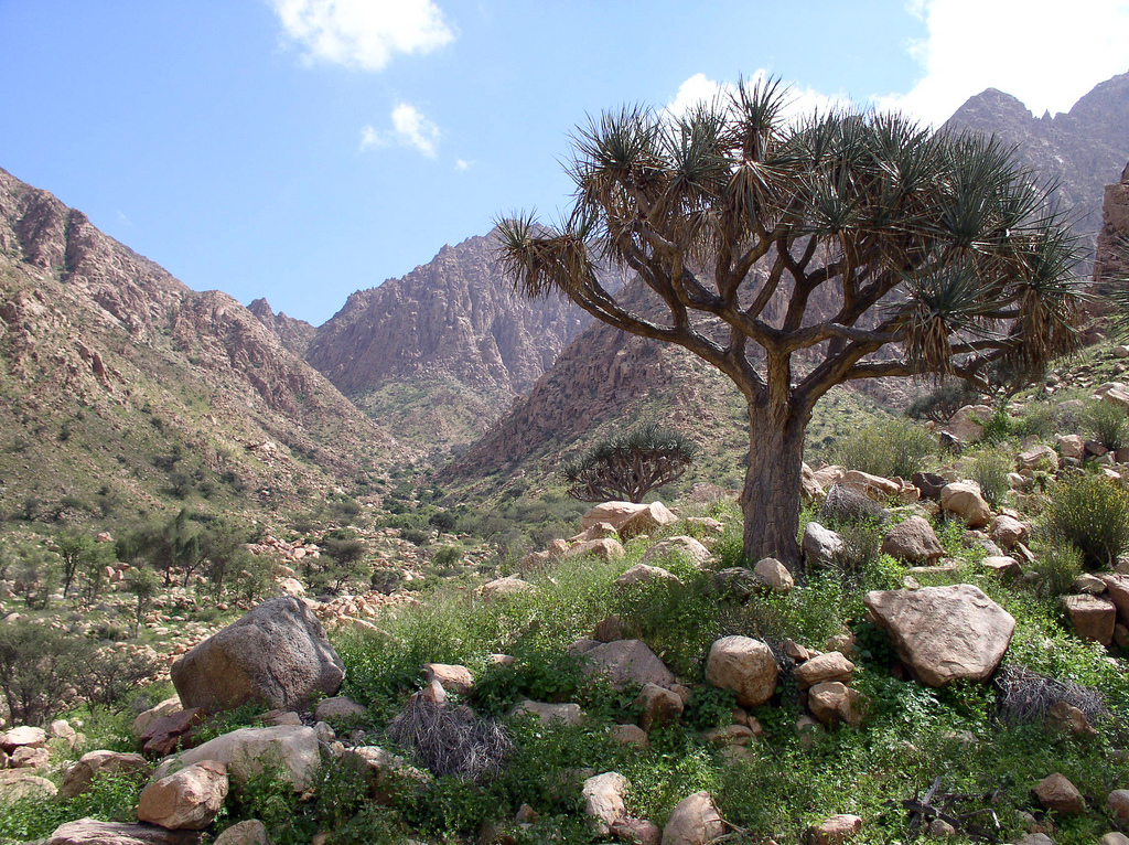
During the winter, peaks exceeding 1,500 metres draw moisture, while in summer they bring on localized storms that are accompanied by violent flash floods and lightning. The plants that thrive in the wake of these floods provide grazing for the desert dwellers, as well as for the several Bedouin tribes that roam the Eastern Desert. These desert nomads are perfectly at home in the wilderness of the Red Sea Mountains.
The most famous of the Red Sea Mountains are:
Jebel Abu Dukhan (Mount Abu Dukhan – Father of Smoke): 1,161 metres
Jebel Gattar with its permanent springs and relatively abundant vegetation: 1,963 metres
Jebel Shaayib Al-Banat (Old Man Mountain) is the highest outside of Sinai: 2,187 metres
Jebel Umm Anab: 1,782 metres
Jebel Abu Hamr: 1,433 metres
Jebel Fatira: 1,356 metres
At Berenice you can find Jebel Farayid (Mount Farayid) Egypt’s most aggressive peak. This mountain is definitely not recommended to those with little climbing experience. In addition to Jebel Farayid, there’s Berenice Bodkin, one of the largest rock spires in all of North Africa. Source Source.
Further south within the Hala’ib Triangle, is Jebel Elba (Mount Elba), the higher peaks in the area are Jebel Elba itself (1,435 m), Jebel Shellal (1,409 m), Jebel Shendib (1,911 m) and Jebel Shendodai (1,526 m).
The summit of Jebel Elba is a “mist oasis” where much of the precipitation is contributed in the form of dew, mist and clouds, creating a unique ecosystem not found anywhere else in the country. It is a “biodiversity hotspot”, with a biological diversity unparalleled in any other terrestrial environment in Egypt. Source.
Mines, Quarries, and Temples
The Eastern Desert was mined and quarried heavily in ancient times by the Ancient Egyptians, during the Ptolemaic dynasties, and later by the Romans. There are three major quarry sites that provide great insight into life in the area in antiquity.
Mons Porphyrites (Mountain of Porphyry) at Jebel Abu Dukhan was an extensive Roman mining operation of the pinkish-purple Porphyry, which was used in temples, baths, sarcophagi and statues. The emperor Hadrian erected the Temple of Serapis, and a stele discovered in 1823 indicates that there was a Christian church, probably financed by Flavius Julius. The Romans also built a fort, stables, cisterns and wells. Source.
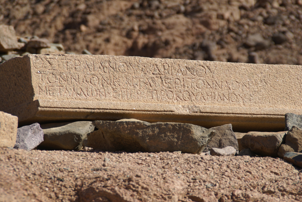
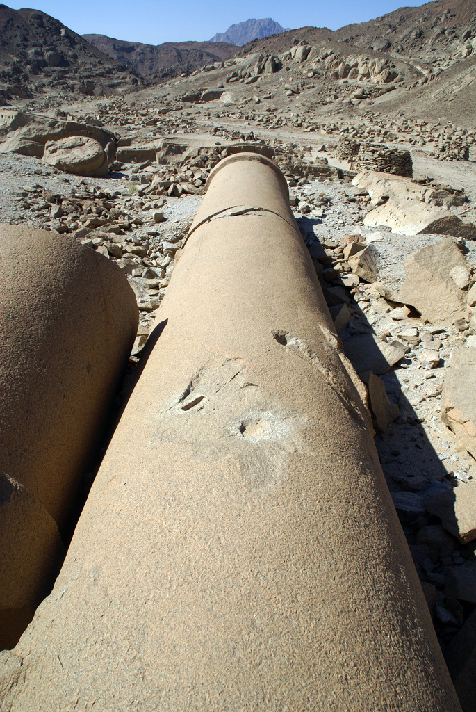
Mons Claudianus, a onetime Roman granite quarry/fortress complex/penal colony, is at the foot of Jebel Fatira, about 30 miles from Port Safaga just off the Qena road. The black stone that was once quarried here can still be seen in the Pantheon, in Hadrian’s Villa, and in Trajan’s Forum. An unfinished temple, a sizeable ruined town, Fons Trajanus, an unfinished giant sarcophagus, and the Mother of all Columns, a 200-tonne immense cracked pillar that was left where it fell 2000 years ago, can all be explored in the area.
Mons Smaragdus (Emerald Mountains), one of the most famous and oldest mining complexes of the ancient world and is believed to be have been used by the Pharaohs of Ancient Egypt. The ruins of the Zabara and Sikeit mining settlements are still visible, as are some remains from temple structures and various old caved-in mining sites. Source.
One of Marsa Alam’s gems is the Temple of Seti I at Khanais; it provides a nice day excursion. However, you can only view the entrance of the temple as it is closed to the public for its protection.
Wadis, Caves, and Rock Art
Over millennia and natural flood paths along the Red Sea Mountains, wadis (valleys) were born. Veins that cut through the Eastern Desert’s landscape, that in times of sudden heavy rain and flash floods can be very dangerous, and about once every 10 years can fill very quickly.
The wadis and caves of the Eastern Desert house Egypt’s best kept secret, that goes by largely unnoticed due to the abundance pharaonic monuments – not a fault of the monuments, for a while now they have been heavily marketed all over the world.
There’s rock art from predynastic Egypt, at a time when the Eastern Desert was very much akin to sub-Saharan Africa, with drawings of hippos, giraffes, ostriches, and cattle. There’s also paintings that give much insight into life in this part of Egypt from the time of the pharaohs to the time of the Romans.
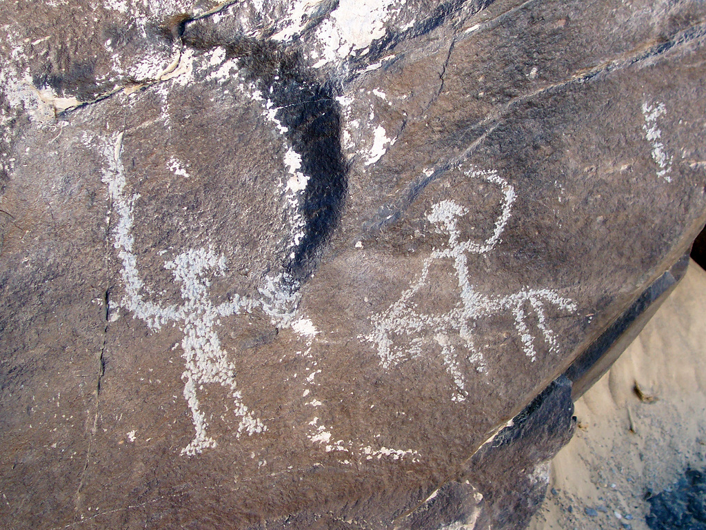
Rock art at Wadi Hammamat, these glyphs probably date back to predynastic times. By random field notes (Ashleigh), Flickr.
The most famous of these wadis are: Wadi Hammamat with its beautiful pharaonic inscriptions, Wadi Qash and Wadi Atwan with their pre-dynastic paintings, Wadi Mineh with the greatest wealth of petroglyphs and rock art in Egypt, Wadi Barramiyah, Wadi Umm Salam – dubbed the “Canyon of the Boats” that houses what some believe to be a predynastic map of the area.
National Parks of the Eastern Desert and the Red Sea
There are three major National Parks and Protectorates within the Red Sea and Eastern Desert. Up in the north end of the coast there’s the North Islands Protectorate, further south close to Marsa Alam there’s Wadi Al-Jemal National Park, the third largest wadi in the Eastern Desert draining into the Red Sea, and one of the best vegetated; Last but not least Elba National Park is located in the southern eastern part of the eastern desert.



Hi M,
Thank you for your contact. My French is a little rusty, but I think I got what you are asking about.
The road to Mons Claudianus should not be closed as far as I know, but with all that’s been happening in Egypt, the authorities sometimes like tourists to travel with a tour operator instead of a taxi. Maybe that’s why the taxi driver didn’t want to drive you there. The best way to get to Berenice and Mons Claudianus is to contact reputable operator, and I have a couple of contacts that might be able to help, please send me an email through the contact form and I can send you these contacts.
Islam
Bonjour à vous.J’ai un certain âge mais je rêve tj de visiter ces “ruines”.Une fois nous avions payé un taxi, près de marsa alam, mais au bout d’un moment il a décrété que la route était “coupée pour les monts claudianus (hum!hum!), une sorte d’arnaque quoi… Comment faire pour les visiter et aussi Berenice? merci de me répondre.m.agnès.